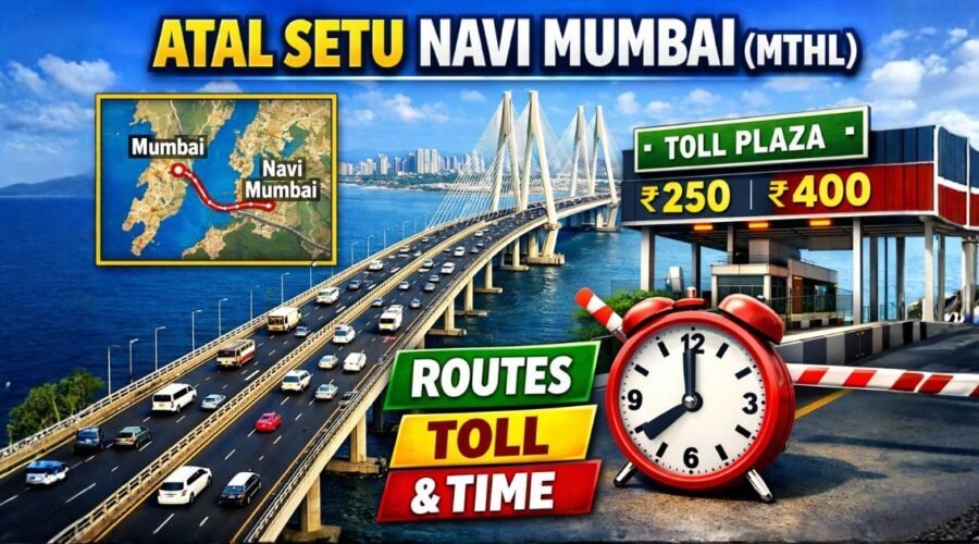
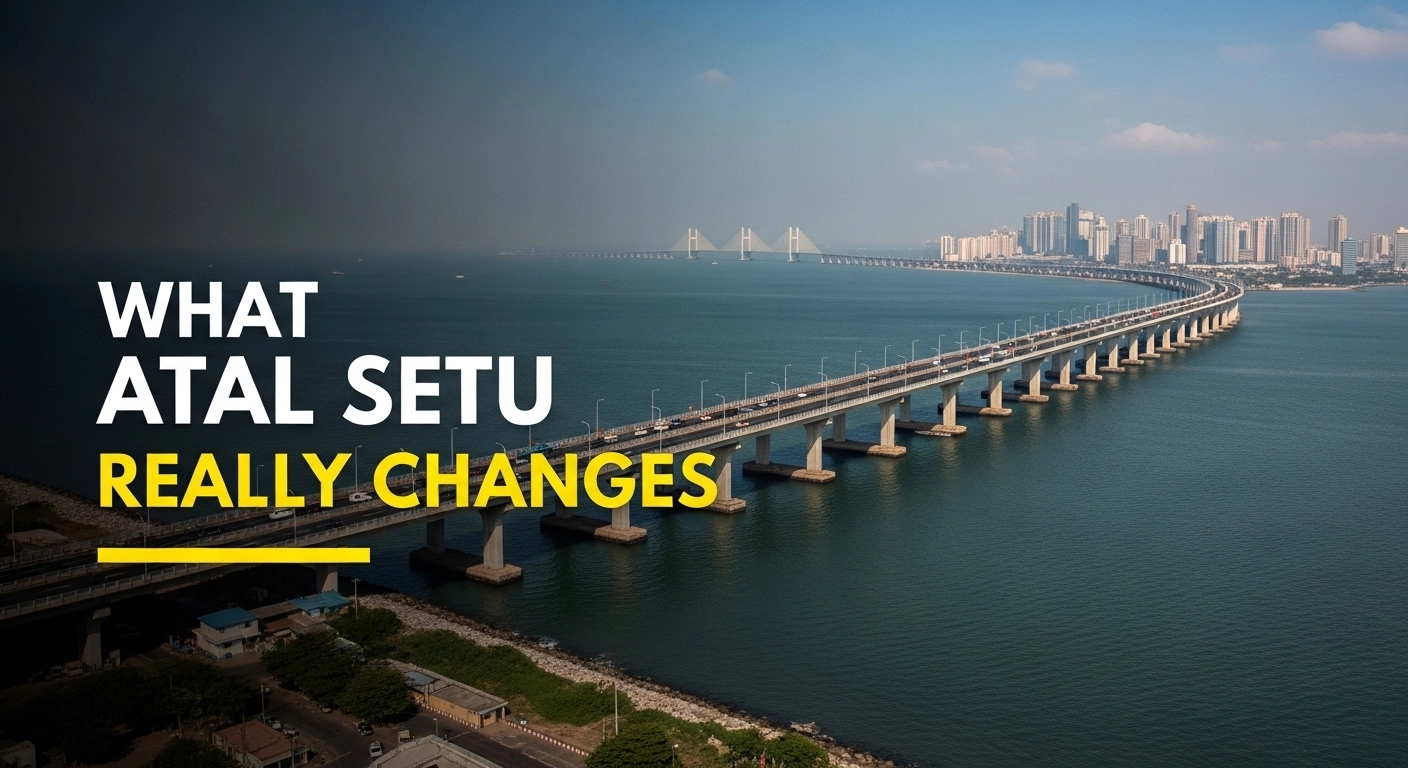
Atal Setu Navi Mumbai (MTHL): Routes, Toll & Time
Atal Setu, officially the Atal Bihari Vajpayee Sewri–Nhava Sheva Atal Setu, is the Mumbai Trans Harbour Link connecting Sewri in South Mumbai to the Nhava Sheva–Chirle side toward Navi Mumbai. It is a 21.8 km, six-lane access-controlled toll corridor opened in January 2024. For Navi Mumbai, its real importance is not just faster travel. The bigger story is that it changes access logic most strongly for southern corridors such as Ulwe, the airport belt, Nhava Sheva, Dronagiri, and Panvel-side movement.
A lot of articles stop at “India’s longest sea bridge” and leave it there. That is not enough. The real question is simpler: what does Atal Setu actually change for daily travel, local areas, property decisions, and the future shape of Navi Mumbai?
Quick summary: what readers should know first
| Point | Practical answer |
|---|---|
| What is Atal Setu? | A Mumbai–Navi Mumbai sea bridge, also called MTHL |
| Official route logic | Sewri in Mumbai to Nhava Sheva/Chirle side near southern Navi Mumbai region |
| Length | About 21.8 km |
| Open since | January 2024 |
| Type | Six-lane, access-controlled, toll corridor |
| Best direct benefit zone | Ulwe, airport-side belt, Nhava Sheva, Dronagiri, Chirle, Panvel-linked southern corridor |
| Limited direct daily benefit zone | Vashi, Nerul, Seawoods, Ghansoli, Airoli |
| Two-wheelers allowed? | No |
| EV toll policy | Full exemption for EVs under the current state relief regime |
| Key caution | It saves major time only when your origin and destination actually suit the corridor |
What is Atal Setu (MTHL), and why does it matter beyond the headline?
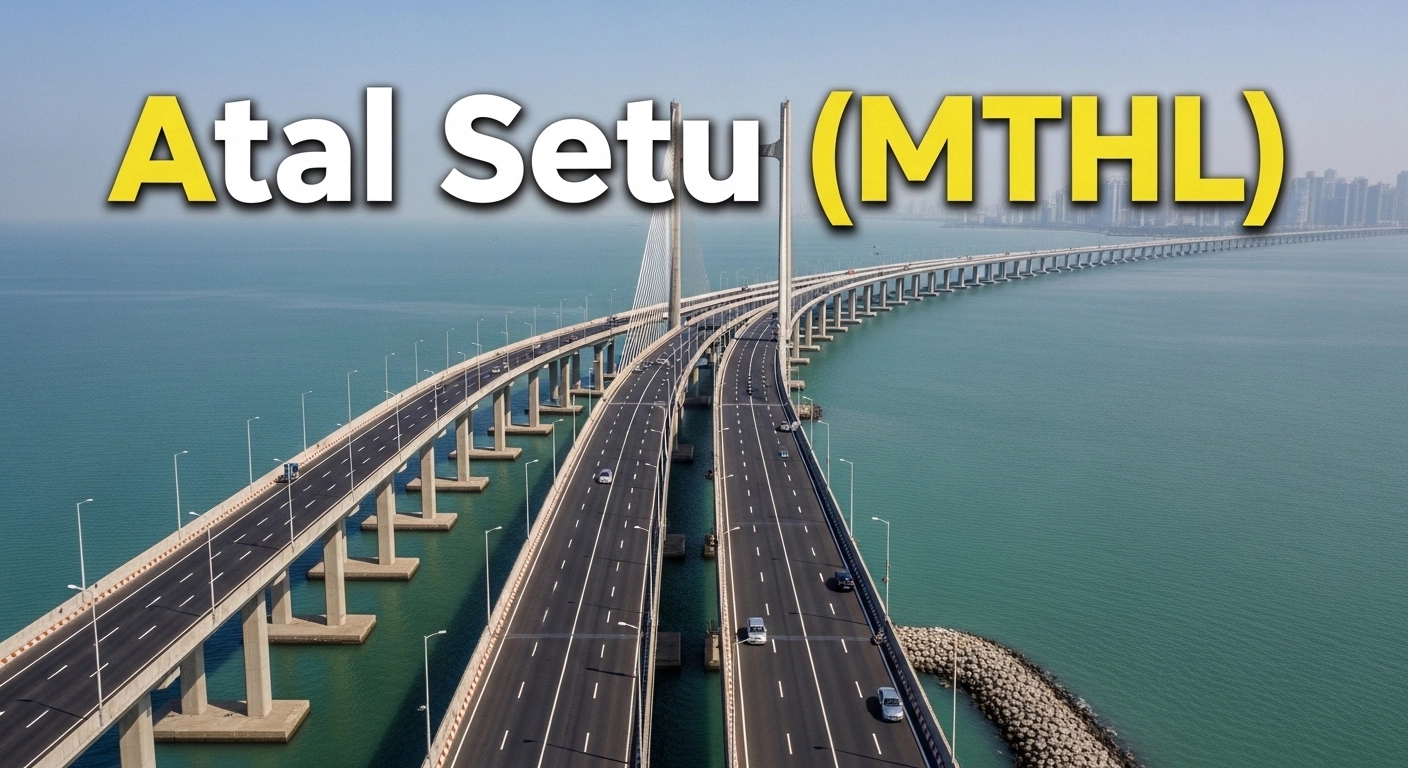
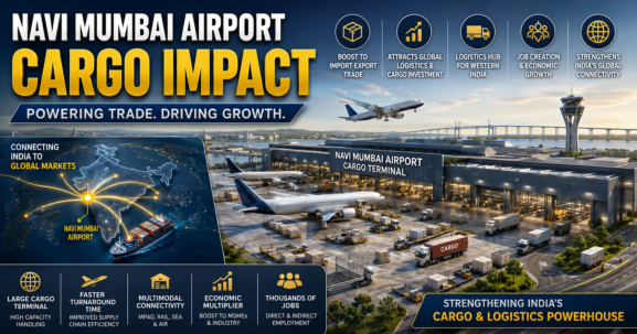
Atal Setu matters because it is not just a bridge. It is a regional connector that changes how Mumbai and the mainland side of the MMR interact. Official project data describes it as an approximately 21.8 km six-lane corridor, with about 16.5 km over sea and about 5.5 km on land. It opened to traffic in January 2024.
For Navi Mumbai, the deeper story is geography. Earlier, many southern corridors felt psychologically and practically farther from South Mumbai. Atal Setu reduces that distance in a way older routes often could not. It also supports a larger infrastructure chain that now includes a live Navi Mumbai airport ecosystem and the wider airport-influence growth belt.
So yes, the structure is impressive. But the real 2026 value is this: Atal Setu rewires access for the southern side of Navi Mumbai more than it transforms everyday life for the entire city equally.
Where exactly does Atal Setu start, end, and connect in the Mumbai–Navi Mumbai system?
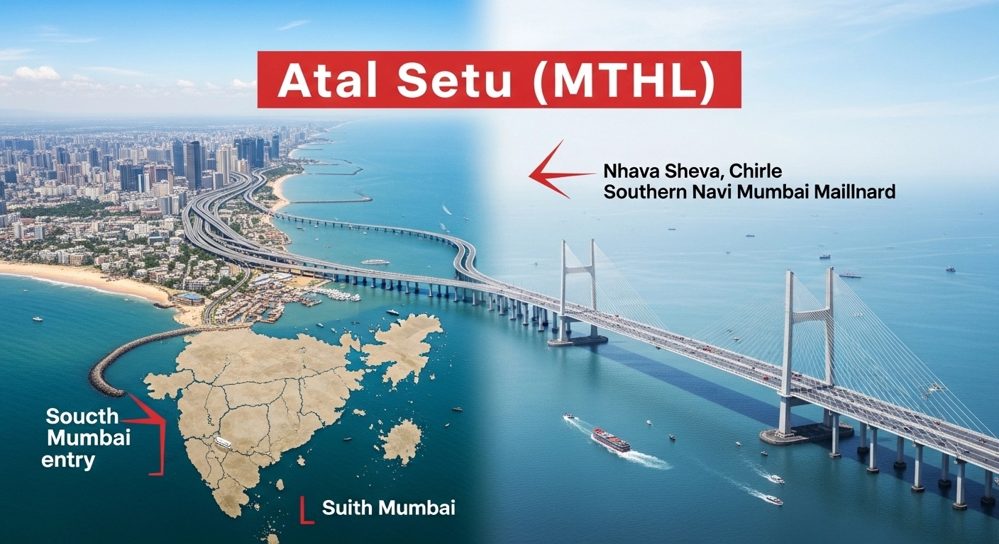
The bridge starts from the Sewri side in South Mumbai and lands toward the Nhava Sheva–Chirle side on the Navi Mumbai mainland side. Major interchanges are associated with Sewri, Shivaji Nagar/Gavhan, and Chirle.
This is where many readers get confused. “Connected to Navi Mumbai” sounds broad, but on the ground it is very specific.
Sewri side
For South Mumbai traffic, Sewri is the gateway. That makes the corridor naturally more useful for people whose movement is tied to South Mumbai, Eastern Freeway-side access, and related city corridors.
Shivaji Nagar/Gavhan side
This part matters heavily for the Ulwe–airport belt. It is the section that makes the airport-side logic stronger than before. There has been active work around a signal-free cloverleaf interchange at Shivaji Nagar to improve Atal Setu-to-airport connectivity, but this should still be described carefully as a connector project under development rather than treated as a fully solved last-mile story.
Chirle side
Chirle is important because it pulls the bridge into the JNPT–Nhava Sheva–Dronagiri–Panvel-side geography. That is why the bridge has a much stronger impact on southern and logistics-facing corridors than on older central and northern Navi Mumbai nodes.
What does Atal Setu actually change for travel time and daily movement?
At corridor level, Atal Setu changes travel time in a big way. But daily travel is not measured only by the bridge deck. It is measured from your actual starting point to your actual ending point.
Where the time savings are real
The bridge is most useful when the trip is something like:
- South Mumbai to Ulwe
- South Mumbai to airport-side Navi Mumbai
- South Mumbai to Nhava Sheva or Dronagiri-side movement
- Mumbai side to JNPT-linked corridors
- Certain longer southern Navi Mumbai trips where the old mainland bottleneck is avoided
In such cases, Atal Setu can feel genuinely transformative.
Where the claim is often overstated
If a person starts from places far from the Sewri entry side, the calculation changes. For example, commuters from western suburbs or some eastern suburbs may still spend meaningful time just reaching the bridge approach. In those cases, the sea crossing may be fast, but the total journey may not feel as dramatic as marketing language suggests.
That is why “Mumbai to Navi Mumbai in 20 minutes” should be treated as a corridor possibility, not a universal door-to-door promise.
Which Navi Mumbai areas feel the impact of Atal Setu the most?
This is the most important local question, and this is where generic articles usually fail.
Atal Setu does not benefit every Navi Mumbai node equally. In practical terms, it creates something close to two different Navi Mumbai realities.
The areas with the strongest direct impact
| Area / belt | Impact level | Why |
|---|---|---|
| Ulwe | Very high | Airport-side relevance, southern access logic, direct regional visibility |
| Pushpak Nagar / airport influence belt | High | Stronger connectivity narrative tied to NMIA-side growth |
| Dronagiri | High for logistics/investment logic | Better relevance in the broader southern corridor and port-linked geography |
| Nhava Sheva / JNPT side | Very high for freight and regional movement | Strategic transport and logistics benefit |
| Panvel-side southern influence zone | Moderate to high, depending on exact location | Gains more through the broader southern growth system than by bridge proximity alone |
The areas with limited direct daily impact
| Area / belt | Impact level | Ground reality |
|---|---|---|
| Vashi | Limited direct daily benefit | Old travel patterns remain more relevant for many users |
| Nerul / Seawoods | Limited to indirect sentiment benefit | Not the primary landing-side advantage zone |
| Ghansoli / Koparkhairane / Airoli | Minimal direct benefit | Geography does not align with the bridge’s strongest use-case |
This difference matters. A person in Ulwe can genuinely feel Atal Setu in area positioning, airport-side access logic, and regional perception. A person in Airoli generally cannot treat the bridge as a daily-life game changer in the same way.
Does Atal Setu really increase property value, or is that only a sales pitch?
The honest answer is: yes, it can increase value, but not in the lazy way many sales pitches suggest.
Infrastructure improves value when it improves access, confidence, and actual use. Atal Setu has clearly done that for parts of southern Navi Mumbai. But by 2026, the simple “buy anything because the bridge is here” phase is already too shallow.
The bridge helped drive a strong pre- and post-opening sentiment shift in southern markets. In the Panvel and Ulwe corridor, the change in pricing over the last few years has been real. But that kind of trend should be treated as historical market movement, not as a guarantee of repeat short-term gains. For publishing, such market figures are best framed as corridor-level trend indicators rather than universal project-level truth.
What is real
- Access perception improved sharply in the southern belt
- Airport-side areas gained credibility
- Institutional and long-term investor interest became more serious
- Ulwe and nearby southern corridors no longer look like distant speculative edges in the way they once did
What is not safe to assume
- That every project near the broader region will automatically outperform
- That old civic weaknesses disappear because one mega project opened
- That all of Navi Mumbai gets the same infrastructure premium
- That short-term profit is guaranteed just because Atal Setu exists
A practical example
A buyer considering a self-use home in Ulwe may now view the area differently because the airport is operational and the wider southern corridor has stronger Mumbai access than before. That is a real utility story.
But a buyer purchasing in a random project purely because a broker says “Atal Setu se rates double honge” should slow down. At this stage, project quality, approach roads, social infrastructure, occupancy profile, and actual livability matter more than headline hype.
Toll, vehicle rules, and practical usage questions readers usually have
This is the section many readers actually search for first.
Atal Setu is a toll corridor. It does not allow cycles, two-wheelers, three-wheelers, tractors, and other slow-moving or unsuitable vehicle categories. Stopping on the bridge is prohibited. The main carriageway speed limit is 100 km/h, while ramps and approaches run at lower permitted speeds.
Recent policy treatment has kept the concessional passenger car toll at ₹250 for a single trip through 2026, and EVs are under full toll exemption under the current relief framework. Since toll policy is government-driven, it should always be rechecked if this article is updated later.
Practical Atal Setu usage checklist
- Passenger car single-trip toll: currently ₹250 under the extended concession regime
- EVs: currently fully exempt from toll under the state relief policy
- Two-wheelers: not allowed
- Auto-rickshaws / three-wheelers: not allowed
- Stopping for photos: not allowed
- Main speed cap: 100 km/h
- FASTag-based movement is the normal operating logic on the corridor
Atal Setu vs the older Mumbai–Navi Mumbai travel options: when does it make sense and when does it not?
Atal Setu is not automatically the best route for everyone. It is the best route for the right trip type.
| Travel situation | Smarter route logic |
|---|---|
| South Mumbai to Ulwe / airport-side belt | Atal Setu often makes strong practical sense |
| South Mumbai to Nhava Sheva / JNPT side | Atal Setu is highly relevant |
| Western suburbs to central Navi Mumbai | Older routes may still remain more practical depending on traffic |
| Airoli / Ghansoli commuter logic | Atal Setu is usually not the defining route |
| Cost-sensitive daily private car use | Toll must be weighed against time saved |
| EV commuter on suitable corridor | Atal Setu becomes much more attractive because toll barrier drops |
There is also a public transport angle now. NMMT’s Atal Setu-linked AC services have made the corridor more usable for non-car commuters too, and that matters because the bridge is no longer only a private vehicle story. For some users, it has become a premium bus corridor as well.
What Atal Setu changes for the future of Navi Mumbai, and what it still does not solve
The bridge changes the long-term map of the region. That is the bigger story.
With NMIA now operational, the southern side of Navi Mumbai is no longer discussed only as future promise. It is entering a live phase of airport-region economics. At the same time, the broader planning narrative around Karnala-Sai-Chirner New Town, often called Third Mumbai, shows how the state sees this southern corridor not as fringe land but as a serious expansion zone linked to the bridge, airport, and wider regional development logic.
But this is where caution is important.
What Atal Setu does solve
- Regional access between Mumbai and the southern mainland
- Stronger airport-belt credibility
- Better logistics relevance for JNPT-side movement
- A major psychological and practical shift in how southern Navi Mumbai is perceived
What Atal Setu does not solve by itself
- Every last-mile road issue
- Internal civic quality in all southern nodes
- Local congestion everywhere
- Uneven development standards across projects and sectors
- Automatic growth in every Navi Mumbai micro-market
That is why the bridge should be seen as macro infrastructure with selective micro-market benefits, not as a magic shortcut that fixes everything.
Should ordinary readers, buyers, and investors treat Atal Setu as a major factor?
Yes, but not equally.
For commuters
Treat it as a major factor only if your route actually aligns with it. If your travel pattern is South Mumbai to southern Navi Mumbai, it can matter a lot. If your daily movement is in northern Navi Mumbai or toward Thane-side logic, it matters far less.
For self-use homebuyers
If you are evaluating Ulwe, Pushpak Nagar, or other airport-influence locations, Atal Setu is now a legitimate part of the area’s long-term livability story. Not the only factor, but a real one.
For investors
The bridge still matters, but the easy money phase is not the right lens anymore. In 2026, the better question is not “Will Atal Setu raise prices?” It is “Which micro-markets still have sustainable upside after the bridge and airport premium are already partly priced in?”
That is a more mature question, and it leads to better decisions.
Conclusion
Atal Setu is one of the most important infrastructure shifts in the Mumbai–Navi Mumbai region, but its value becomes clear only when you stop looking at it as a headline project and start looking at it as a route, an area connector, and a decision factor.
For southern Navi Mumbai, especially Ulwe, the airport belt, Nhava Sheva-side zones, Dronagiri, and parts of the wider Panvel influence area, the bridge is a real game changer. For Vashi, Nerul, Seawoods, Ghansoli, or Airoli, the effect is much more indirect.
So the correct takeaway is not “Atal Setu changed everything.” It is this: Atal Setu changed some corridors dramatically, strengthened the long-term case for southern Navi Mumbai, and made the region’s geography more unequal in opportunity, not more equal. That is the practical truth readers, buyers, commuters, and investors should understand.