
Dronagiri Fort Uran Navi Mumbai – History, Location & Complete Travel Information
Dronagiri Fort is a historic hill fort located in Uran near Navi Mumbai, Maharashtra. It is known for its panoramic Arabian Sea views, Portuguese-era church ruins, beginner-friendly trek route, and its strategic location overlooking JNPT and ONGC installations.
If you love short treks, coastal history, abandoned ruins with stories, and less crowded viewpoints, this place is honestly perfect. Not commercial. Not polished. Just raw history sitting quietly above Uran town. Some people come for photography. Some for mythology. Some just to escape city noise for two hours.
Quick Summary Table - Dronagiri Fort 2026 Guide
Dronagiri Fort: Quick Trek & Travel Guide
Where is Dronagiri Fort Located?
Dronagiri Fort is situated on the Karanja Peninsula in Uran taluka of Raigad district, Maharashtra. It stands around 111 meters above sea level, overlooking the Arabian Sea and the massive container terminals of JNPT.
Geographically, it sits in a very unusual position. On one side you see pure sea and fishing boats. On the other side, you see oil tanks, cargo cranes and industrial giants. Old world. New world. Same frame. That contrast is what makes this fort so unique in 2026.
Dronagiri Fort Uran Exact Location
The fort is located near Dronagiri village in Uran, close to JNPT Road and the ONGC gas processing plant. Its approximate coordinates are 18°52’01″N, 72°56’09.3″E.
From Uran ST Bus Stand, the base village Daurnagar is about a 10-minute walk. The trekking trail begins near a power transformer close to the first slope of the hill. There is no large entry gate or ticket counter. It feels almost hidden. You have to look for it.
Distance from Navi Mumbai & Mumbai
From Belapur, Dronagiri Fort is roughly 25 to 30 km depending on your route via Palm Beach Road and JNPT Road.From Vashi, it is approximately 40 km.
From South Mumbai via Atal Setu and Nhava-Sheva stretch, it can take around 1.5 hours depending on traffic near JNPT container terminals.Travel time matters here. Especially during cargo peak hours. JNPT truck movement can slow things down near Nhava-Sheva junction. Plan accordingly. Early morning is always better.
Nearest Railway Station to Dronagiri Fort
The nearest railway station is Uran Railway Station on the fully operational Belapur–Nerul–Uran suburban railway line.As of 2026, around 50 local train services run daily between Uran and Belapur. AC local trains were also introduced recently, which makes the ride surprisingly comfortable.
From Uran station, the fort base is around 2.5 to 3 km. You can take
- Auto rickshaw – ₹40 to ₹70
• Shared auto – ₹20 per person
Dronagiri Station is technically closer to the residential node, but most trekkers still prefer getting down at Uran station because directions are clearer from there.And honestly, asking locals for directions is half the experience. They will say, “Fort? Church wala dongar? Seedha jao.” And you smile. Because that’s how local travel should feel.
Quick Location Snapshot Table
| Detail | Information |
|---|---|
| Location | Dronagiri Village, Uran, Raigad District |
| Height | 111 meters above sea level |
| Nearest Station | Uran Railway Station |
| Distance from Belapur | Approx 25–30 km |
| Base Village | Daurnagar |
| Access Road | JNPT Road via Nhava-Sheva |
Dronagiri Fort, Uran – Complete Travel Guide
Dronagiri Fort in Uran is one of Navi Mumbai’s hidden gems. With improved connectivity, major infrastructure upgrades, and the operational Atal Setu, visiting this historic hill fort has become easier than ever in 2026.
How to Reach Dronagiri Fort
How to Reach Dronagiri Fort Uran
Reaching Dronagiri Fort has become significantly easier in 2026 due to the new Uran railway line and the Atal Setu.
By Train (Most Convenient)
The nearest railway station is Uran Railway Station. From Belapur or Nerul, take the suburban local train to Uran. From the station, the base village (Daurnagar) is a 10-minute auto-rickshaw ride (Fare: ₹40–₹70).
By Road (Via Atal Setu / MTHL)
If driving from South Mumbai, take the Atal Setu to Chirle, then connect to JNPT Road towards the Dronagiri node. The total travel time is approximately 35–45 minutes, avoiding old Vashi traffic.
Trek Details
- Difficulty Level Easy to Moderate
- Climbing Time 20–30 minutes
- Best Time to Visit October to February
- Sunset Views Highly recommended
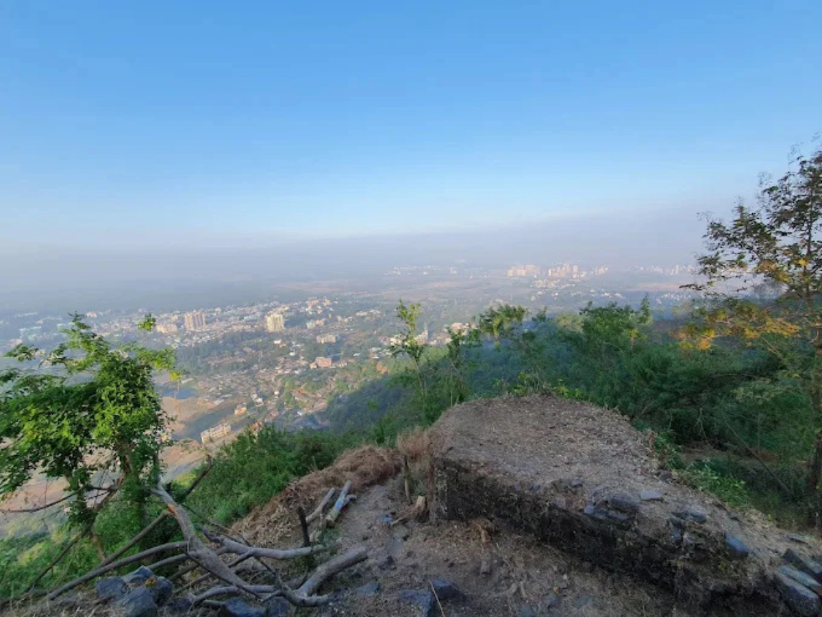
From the top, visitors get panoramic views of ONGC installations, the JNPT port region, and the Arabian Sea.
Dronagiri Fort History – The Legend Behind Dronagiri Killa
Dronagiri Fort is not just another ruined structure near Navi Mumbai. It is a layered story of ancient trade routes, Portuguese missionaries, Maratha naval wars, British demolition, and a Ramayana legend that still lives in local belief.
If you stand on the Balekilla and look at the Arabian Sea… you can almost imagine ships approaching the harbor five hundred years ago. Salt traders. War vessels. Missionary boats. Then later British steamers. Same sea. Different rulers.
Historical Background of Dronagiri Hill
Human settlement in the Uran region dates back to the Satavahana period. Inscriptions found in Mor village suggest administrative systems as early as the 2nd century BCE. Later in the 7th century, the Chalukyas controlled nearby Gharapuri, now known as Elephanta Island, which became a major regional center. Naturally, surrounding hills including Dronagiri were strategically important to monitor naval movement.
During the medieval period, the Yadavas of Devgiri strengthened coastal defenses around Uran’s salt pans and trade routes. After their fall in the 14th century, control shifted between Deccan Sultanates before the Portuguese entered in 1530. In 1534, Dronagiri formally became part of the Portuguese Estado da Índia. That changed everything. Architecture. Religion. Military focus.
Connection with Local Folklore & Mythology
According to the Ramayana, when Lakshmana was wounded in battle, Lord Hanuman was sent to fetch the Sanjeevani herb from Mount Dronagiri in the Himalayas. Unable to identify the exact herb, he lifted the entire mountain. Local folklore in Uran says that while flying back to Lanka, a fragment of that mountain fell into the Arabian Sea and formed this hill.
Interestingly, in Uttarakhand’s Himalayan Dronagiri village, there is traditional resentment toward Hanuman for breaking their sacred mountain. But in Uran, the hill is seen as a blessing. The Vetal temple on the slope and saffron flags across the ridge show how deeply this belief still lives.
Who Built Dronagiri Fort?
Dronagiri Fort was originally fortified during the medieval period under regional Hindu dynasties and later significantly strengthened by the Portuguese in the 16th century. It was captured by Maratha commander Manaji Angre in 1739 and later occupied and partially demolished by the British in 1818.
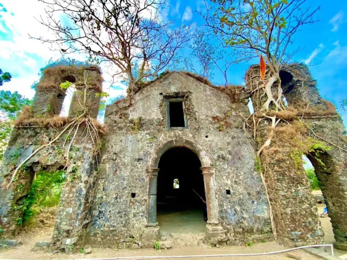
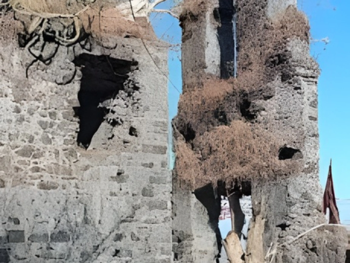
The Portuguese occupation between 1530 and 1739 shaped most of the visible ruins we see today. In 1535, a Franciscan missionary named Father Antono-de-porto constructed three churches on the hill. The most prominent surviving one is Nossa Senhora da Penha.
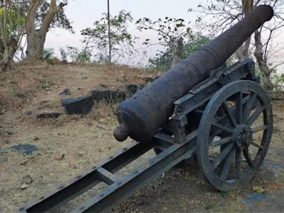
This church was not decorative. It was built with vaulted interiors for structural strength against monsoon and artillery. The entrance stood nearly 12 feet tall. Behind it were small residential annexes for clergy. A 1728 Portuguese report even recorded six artillery guns and a permanent garrison of 50 soldiers stationed here.
On March 10, 1739, Maratha naval commander Manaji Angre captured Dronagiri along with Uran Fort. This happened the same year the Portuguese stronghold of Vasai fell. Under Maratha control, the fort shifted its focus toward monitoring Siddis of Janjira and rising British power in Bombay.
By December 28, 1774, the British East India Company occupied Karanja island. The Treaty of Salbai in 1782 officially ceded it to them. They later installed a lighthouse on top of Portuguese ruins. Finally in 1818, during the fall of the Maratha Empire, Colonel Prother’s forces demolished the fort structures to prevent future insurgent use.
Dronagiri Fort Trek Guide – Route, Difficulty & Duration
Dronagiri Fort trek is considered easy to moderate and is one of the most beginner-friendly treks near Navi Mumbai. The total climb takes around 45 to 60 minutes depending on your pace.It is not a staircase trek. It is not fully marked either. It feels natural. Slightly wild. And that is the charm. No commercial boards. No tea stalls on the way. Just red soil, dry grass, and that occasional sea breeze pushing you upward.
Trek Starting Point at Dronagiri Village
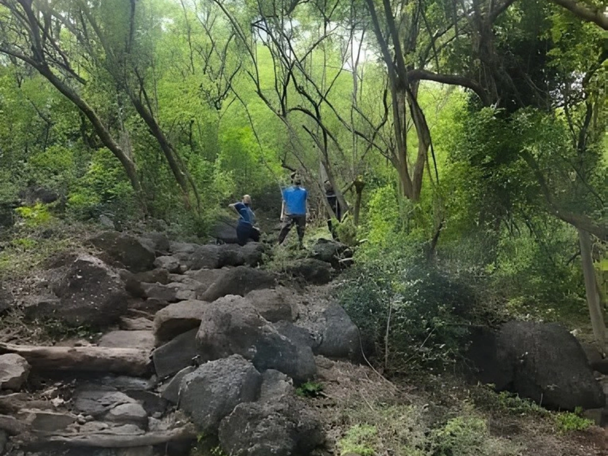
The trek officially starts from Daurnagar near Uran ST Bus Stand. From Uran Railway Station, you can take an auto for ₹40 to ₹70 to reach the base. Shared autos cost around ₹20 per person.Look for a power transformer near the first slope of the hill. That is your unofficial starting marker. The trail first moves right, then curves left as it gains height. Around 10 minutes into the climb, you will encounter a fence. Cross it carefully. This is where the dense Gliricidia sepium forest begins.
The forest section is surprisingly peaceful. During monsoon, it turns green and slightly slippery. In summer, it feels dry and earthy. The trail gradually moves toward the right ridge of the hill. From that ridge, a northern detour leads you straight to the main gates of the fort.No signboards. Just instinct. And sometimes following other trekkers ahead of you.
Trek Difficulty Level
There are no rock patches that require technical climbing. No iron ladders. No vertical exposure points. The incline is steady but manageable. If you can comfortably walk for 45 minutes on uneven ground, you can do this trek.
That said, do not underestimate summer heat. Uran can easily cross 34 to 36 degrees between March and May. There is minimal shade in the first half of the trek. Early morning start is honestly the best decision you can make.
If you are carrying kids, keep them close near the ridge sections. The eastern scarp of the fort is steep. Not dangerous if you stay careful. But not careless-friendly either.
Trek Duration & What to Expect
Average ascent time is 45 minutes. Descent takes around 30 to 40 minutes.Once you reach the Machi level, you will first notice a police chowki. This outpost monitors the nearby ONGC gas plant because the fort overlooks sensitive industrial installations. Occasionally officers may ask basic questions. Just carry a valid ID. Nothing dramatic. Just standard security protocol.
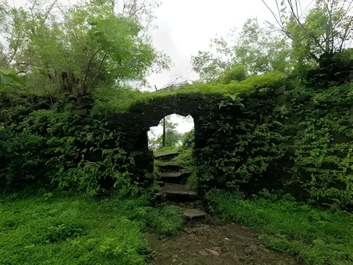
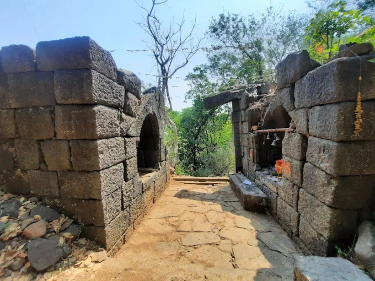
From the Machi, climb further toward the Balekilla. The square-shaped citadel with four bastions becomes visible. The partially collapsed main gate stands about 50 meters south of the old church ruins. Inside one of the guard rooms, you will see a Ganpati idol placed carefully. That idol was originally part of the main gate keystone.
And then you step inside the ruins of Nossa Senhora da Penha.The vaulted ceiling. The broken facade. The silence.Wind passing through old stone arches. You stand there and suddenly realize this hill has seen Portuguese soldiers, Maratha warriors, British officers, Koli fishermen, and now… you.
History of Dronagiri Fort
Dronagiri Fort held strategic importance during the Portuguese era as it was used to monitor Arabian Sea trade routes.
The Maratha Conquest
On 10 March 1739, Maratha Commander Manaji Angre captured the fort.
This victory was part of the famous Bassein Campaign (Battle of Vasai), during which the Marathas significantly weakened Portuguese control in the region.
After this conquest, the fort strengthened Maratha naval dominance along the western coast of India.
What Makes This Trek Different from Other Navi Mumbai Treks?
Most Navi Mumbai treks like Parsik Hill or Kharghar hills are more urban in feel. Dronagiri feels layered. Historic. Industrial backdrop on one side and raw Arabian Sea on the other.
From the western bastions, you can see
- The massive container cranes of Jawaharlal Nehru Port
• ONGC gas processing units
• Fishing boats near Karanja
• On clear days, even the South Mumbai skyline
Dronagiri Fort Timings & Best Time to Visit
Dronagiri Fort does not have a formal ticket counter or ASI gate system because it is currently unprotected. However, due to security presence near the ONGC installation, visitors are expected to vacate before sunset.There is no official “closing bell” but practically, you should finish your visit between 630 AM and 600 PM. Night halts are strictly prohibited. The CISF and local police patrol the area. This is not a camping fort. It is a morning fort.
Visiting Hours
Best visiting window is early morning between 630 AM and 1030 AM.After 11 AM, heat becomes harsh, especially in summer months. Since there are no vendors or shade shelters on top, staying long during afternoon is not comfortable. In monsoon, afternoon clouds can make descent slippery.
Security-wise, early morning visits also avoid unnecessary questioning near the police chowki. Just go, trek, explore, return. Simple.
Sunrise & Sunset Views from Dronagiri Fort
Sunrise from Dronagiri feels calm and wide open. The Arabian Sea reflects soft orange light, and fishing boats slowly start moving. The wind at that hour is cool. You can actually sit near the bastion quietly without sweating.
Sunset is dramatic but tricky. The western sky glows behind ONGC structures and container cranes. It looks cinematic. But you must descend before it gets dark. The forest trail does not have lighting. And honestly, climbing down in semi-darkness here is not worth the risk.
Best Season for Dronagiri Fort Trek
Monsoon between July and September transforms the hill into a green carpet. The Gliricidia forest looks alive. But trails become muddy and slippery. Good shoes are a must.
Winter from November to February is the most comfortable season. Clear visibility. Less humidity. Panoramic views of South Mumbai skyline become sharper.
Avoid peak May afternoons unless you enjoy heat testing your patience. Uran summers are not gentle.
How to Reach Dronagiri Fort Uran
Reaching Dronagiri has become significantly easier after the completion of the Belapur–Nerul–Uran railway line. In 2026, this line operates frequently and connects well with Navi Mumbai nodes.
But planning route timing is important because JNPT container truck traffic can delay road travelers.
By Train – Nearest Station
Nearest railway station is Uran Railway Station on the suburban line connecting Belapur and Nerul.From Belapur to Uran, first train starts around 545 AM. Last return train from Uran toward Belapur is around 1015 PM. Trains run every 20 to 30 minutes during most of the day.
From Uran station to Daurnagar base
Auto rickshaw fare – ₹40 to ₹70
Shared auto – ₹20 per person
Travel time – 10 minutes
Train is honestly the most stress-free option if you are coming from Vashi, Nerul, or Belapur side.
By Road via JNPT & Uran
If coming by car or bike from Navi Mumbai
Route Palm Beach Road → Belapur → Nhava-Sheva → JNPT Road → Uran → Daurnagar.
Distance from Belapur is about 25 to 30 km. Travel time can range from 45 minutes to 1.5 hours depending on truck movement near container terminals.
If coming from Mumbai via Atal Setu, you reach Nhava-Sheva stretch faster. But again, container traffic timings matter. Early morning departure avoids congestion.
Fuel pumps available near Uran include Indian Oil and HP Petrol Pump on JNPT Road. Always better to refill before entering inner Uran roads.
Parking Availability at Base Village
Visitors usually park bikes or cars near Daurnagar houses or open roadside spaces close to the transformer starting point. Locals are generally cooperative, but avoid blocking access roads.Sometimes villagers informally charge ₹20 to ₹30 for parking supervision. It is not official. More like goodwill arrangement.Respect local space. Do not litter. Remember this is a residential village first, trekking spot second.
Local Shops & Basic Supplies Near Uran ST Bus Stand
Before starting trek, buy essentials near Uran ST Bus Stand area. Some known local spots
- Hotel Trimurti – Basic breakfast like poha ₹30, misal pav ₹50
• Sai Snacks Center – Vada pav ₹15 to ₹20
• Ganesh Cold Drinks & General Store – 1 liter water bottle ₹20, biscuits ₹10 to ₹30
• Local fruit vendors – Banana dozen ₹40 to ₹60 depending on season
Carry at least 2 liters of water per person. The Gagoni and Gijoni water tanks on the fort are not potable.There are small medical stores near Uran Bus Stand if you need band-aids or ORS sachets. Basic, but sufficient.
What to See at Dronagiri Fort – Ruins, Views & Attractions
Dronagiri Fort is not about one grand monument. It is about fragments. Broken walls. Silent arches. Bastions facing the sea. A church without a roof but still standing.It does not scream for attention like some famous forts. It whispers. You have to walk around slowly to notice details. The more time you spend, the more layers reveal themselves.
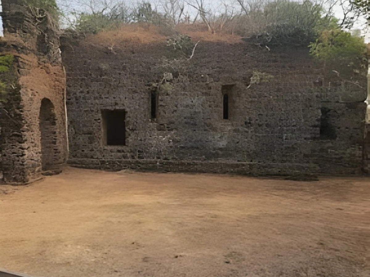
Fort Walls & Ruins
The most striking structure inside the Balekilla is the Portuguese-era church, Nossa Senhora da Penha. Built in 1535, its vaulted interior still shows remarkable structural strength despite centuries of neglect. The entrance once stood nearly 12 feet tall. The facade remains simple, almost military in design.Behind the left bell tower area, you can still see remains of annex rooms which likely housed priests or served as small hospice quarters. Nearby stand the Gagoni and Gijoni rainwater tanks, engineered with brick arches to reduce evaporation. Even today, their masonry holds firm, though the water is not drinkable.
The Balekilla itself is square-shaped with four bastions. Unlike European forts, many internal walls here are built using stacked stone without mortar. The northern gate area features a Ranmandal design where invaders would be trapped in a confined courtyard under crossfire from bastions.And then there is the Ganpati idol inside the guard room. Originally the keystone of the main gate arch. Now resting quietly inside a devdi. That transition from architecture to worship tells its own story.
Coastal & Creek Views
To the north, you see the vast container terminals of the Jawaharlal Nehru Port. Giant cranes moving silently. Ships lined up like patient monsters waiting to unload global cargo.
To the west, the Arabian Sea stretches endlessly. During clear winter mornings, you can even faintly spot parts of South Mumbai skyline. Nariman Point towers look like tiny shadows on the horizon.
To the south, the coastline of Karanja and Revas spreads outward. On very clear days, small silhouettes of Khanderi and Underi forts appear in the distance.
This fort truly feels like a natural watchtower. The wedge-shaped plateau with its steep eastern scarp and open western slope explains why every ruler wanted it.
Dronagiri Village Surroundings
From the Machi level, if you look downward, you see Dronagiri village and patches of the CIDCO-developed Dronagiri node.
Modern apartment buildings like Akshar Estonia stand not too far from centuries-old ruins. It is a strange contrast. Urban expansion pushing toward heritage zones.
Below the southern path lies Vetal Mandir, a small temple with a 2.5-foot red stone idol under a tin roof. This temple symbolizes the return of Hindu worship practices after the Maratha capture in 1739.
Local Koli and Agri communities still perform rituals during Narali Poornima. Coconuts offered to the sea. Fishing boats decorated. Ganesh Chaturthi celebrations lasting up to 21 days. Even trekkers sometimes offer silent respect at the Ganpati idol before descending.
Things to Know Before Visiting Dronagiri Fort
Visiting Dronagiri is simple. But ignoring a few practical details can ruin your experience.
This is not a commercialized tourist fort. There are no security fences protecting you from edges. No snack stalls at the top. No guided boards explaining structures.
Entry Fees
There is no official entry fee.
The fort is currently unprotected by ASI. It falls under government ownership but lacks formal ticketing. Occasionally, local villagers may informally charge ₹20 to ₹30 for parking near base areas.
There are no guided tour charges unless you arrange a private local guide yourself.
Safety Tips for Trek
Carry valid ID proof. The police chowki near the Machi monitors the area because the fort overlooks ONGC facilities. Photography of ONGC plants or security installations is strictly prohibited.
Avoid venturing too close to steep eastern edges. During monsoon, soil can loosen. Wear proper trekking shoes. Slippers are a bad idea here.
Do not attempt night stay. Sunset descent should begin before 6 PM.
Carry Essentials for Dronagiri Trek
Cap or hat during summer. Light snacks like bananas, glucose biscuits, dry fruits. Basic first-aid kit.
And most importantly, carry back your waste. The Gliricidia forest belt is sensitive. Littering not only damages environment but also angers locals.
Nearby Places to Visit Around Dronagiri Fort Uran
If you are already in Uran, you can extend your half-day trip into a relaxed coastal circuit.
Karanja Fort
Karanja Fort lies closer to the coast and has historical links to Portuguese and Maratha control of the peninsula. Though less intact than Dronagiri, it complements the maritime defense story of the region.
Combine both if you are a history enthusiast. But be prepared for rougher access routes.
Uran Beach
Uran Beach is around 10 to 12 minutes from Dronagiri village by vehicle. It is relatively quieter compared to popular Navi Mumbai beaches.
Evening visits here show fishing boats returning with catch. Local fish markets nearby sell fresh pomfret between ₹400 to ₹700 per kg depending on season. Raw, authentic coastal life. Not Instagram-perfect. Real.
JNPT Viewpoint
Driving along JNPT Road offers industrial panoramic views of India’s largest container port, Jawaharlal Nehru Port Authority.
Photography of port facilities is restricted in certain zones. Always respect signage. But visually, seeing global trade happening right beside an ancient fort makes you think about continuity of maritime importance.
The harbor has never stopped being strategic.
Is Dronagiri Fort Worth Visiting?
If you are expecting a polished heritage monument with ticket counters, guide boards, selfie spots and food stalls, you might feel disappointed. Dronagiri is not curated. It is not protected. It is slightly neglected. And maybe that is exactly why it still feels real.
But if you enjoy quiet places, layered history, abandoned Portuguese churches, Maratha defensive layouts, sea breeze on bastions, and that strange industrial skyline contrast… then yes. It is absolutely worth visiting. Especially if you live in Navi Mumbai and want something different from the usual Kharghar hill walks.
This fort feels like standing between centuries. One side Arabian Sea. One side ONGC gas plant. One side CIDCO apartments. And under your feet, 500 years of power struggles.
Conclusion
Dronagiri Fort is not dramatic in size. It does not have massive intact walls like Raigad or Lohagad. But it has something subtler. A quiet resilience.
Built. Captured. Modified. Demolished. Still standing.
And maybe that is the real reason to visit. Not just for a trek. Not just for photos. But to stand on that bastion and realize how many empires once stared at the same sea you are staring at.
FAQs
Frequently Asked Questions