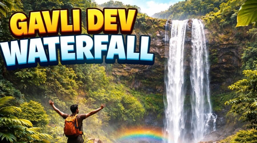
Gavli Dev Waterfall Mahape: Trek Route, Best Time & Safety Tips
Gavli Dev Waterfall is one of those monsoon spots in Navi Mumbai that feels surprising because it sits right at the edge of the Ghansoli–Mahape belt, where industry and forest meet. It is not a remote Western Ghats waterfall. It is an urban-forest cascade, shaped by the Parsik Hill ridge and visited by thousands during peak rains.
What makes this place rank-worthy for a guide is clarity: where it starts, why it flows so fast after rain, what the trek actually feels like, and what safety risks people ignore when the crowd mood takes over. This guide is structured for first-time visitors, families, and casual trekkers looking for a practical Navi Mumbai plan.
Quick Facts at a Glance
The waterfall sits on Parsik Hill’s western slope and is accessed via the MIDC Central Road network, which makes it unusually reachable compared to deeper trekking zones.
On the trail, the common experience is a short trek, a monsoon crowd wave, and a viewpoint that opens up towards the Ghansoli–Airoli skyline and Thane Creek side.
History and Name Origin: Why It Is Called Gavli Dev Waterfall
Gavli Dev Waterfall is locally named after the small Gavli Dev or Gavli Devi shrine located on the Parsik Hill trail. In Navi Mumbai, many natural points are identified by the nearest temple or long-standing local landmark, so the waterfall adopted the same name that people already used for the trail and the hilltop.
The word “Gavli” is also commonly associated in Maharashtra with pastoral and dairy-linked local usage, which is why many people interpret “Gavli Dev” as a community-linked protector deity name. This is best understood as a local-language explanation rather than an official historical plaque, so it should be written as “locally known as” for accuracy.
Where Exactly Is Gavli Dev Waterfall?
Gavli Dev Waterfall is positioned on the western slopes of the Parsik Hill range, within the Ghansoli and Mahape node area of Navi Mumbai. The site functions like a municipal nature spot because of how people use it, even though it sits in a forest and ridge setting.
The strongest way to understand the location is simple: it is a boundary line. On one side is the “gray” infrastructure of MIDC and the industrial-residential belt, and on the other side is the “green” infrastructure of reserved forest and ridge ecology. That edge-location is why it is accessible, and why it is vulnerable.
Why This Waterfall Exists Here
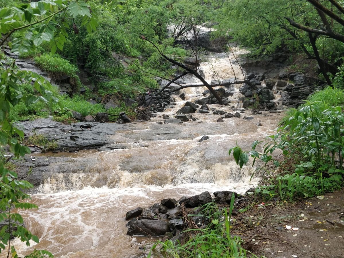
Parsik Hill is a long ridge (around 7 km) that runs parallel to Thane Creek, and it behaves like a natural barrier during the south-west monsoon. The ridge forces orographic rainfall, which feeds the Gavli Dev stream and creates high-velocity cascades in rainy weeks.
The ridge elevation reaching roughly 235 meters gives enough slope and gradient for the waterfall to form with strong force during peak rain. This is why the site becomes active mainly in monsoon, and why the flow can feel dramatic even though the catchment is local and compact.
Geological Story in Simple Words: Deccan Traps
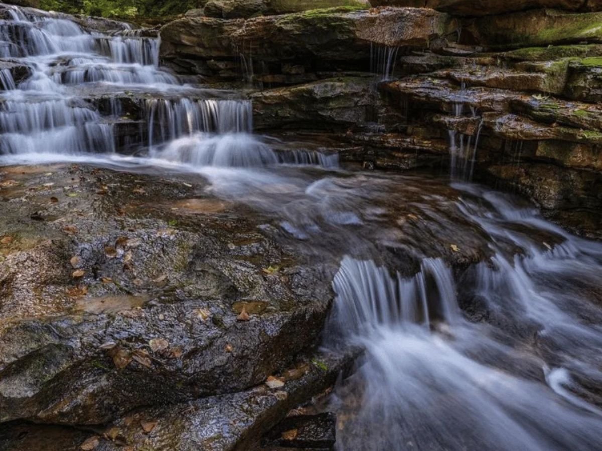
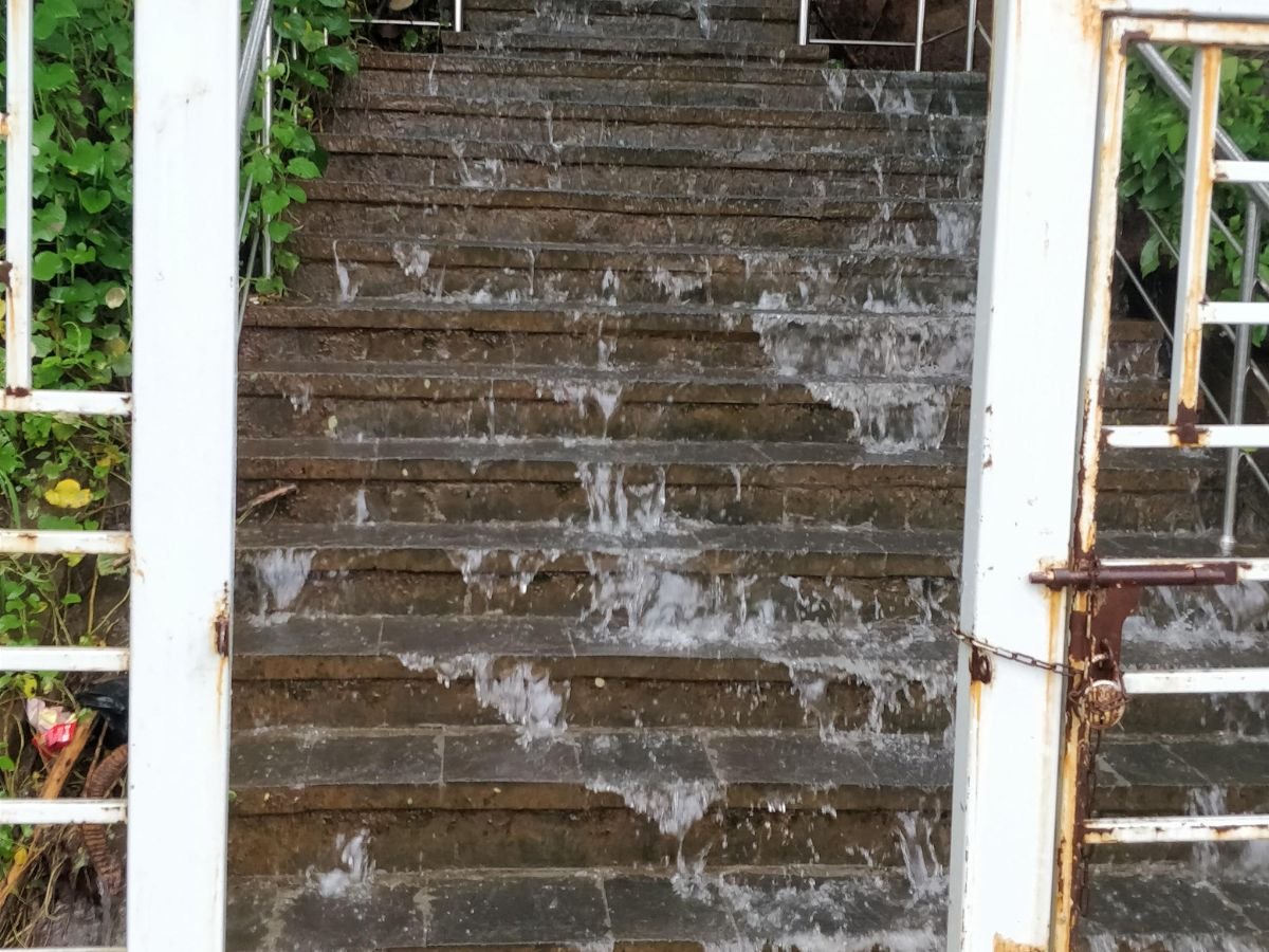
The terrain here is classic Deccan Traps basalt, formed around 65–66 million years ago. The waterfall drops over step-like basalt layers, which is why the rock often feels like natural stairs in parts.
Between basalt flows, thin intertrappean layers can hold water and release it slowly as seepages after monsoon, supporting greenery around the falls into the early dry season. It is also worth noting that the wider Parsik range has quarrying scars, which can disturb slope stability and drainage patterns around the ridge.
Hydrology: Why the Waterfall Swells So Fast
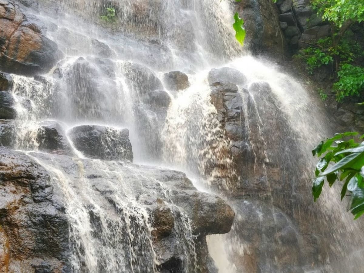
Gavli Dev is a seasonal, rain-fed waterfall. It is not a perennial spring system. Its flow depends heavily on surface runoff from the ridge above it, which is why it can surge quickly right after a downpour.
The exposed basalt in the catchment has low permeability, meaning rain converts rapidly into runoff. This creates a “flashy” waterfall behavior: it swells within minutes of intense rainfall and can reduce quickly when rain stops. That same fast behavior is what makes timing and safety planning so important here.
How to Reach Gavli Dev Waterfall (Step-by-Step)
The most practical access is through Mahape MIDC, because the approach road is part of a major industrial artery and stays reachable even in peak monsoon. The site is accessed via MIDC Central Road, which connects the industrial zones of Thane and Belapur and acts as the main spine for reaching the trail area.
In simple terms, your travel plan should be: reach the Ghansoli–Mahape belt, get to the MIDC electronic zone side, and then start walking where the “city ends and scrub begins.” This edge location is exactly why Gavli Dev feels like an urban forest micro-adventure, not a faraway trek.
Trailhead Location: Where the Trek Actually Starts
The trek begins near the MIDC electronic zone in Mahape, and that contrast is the most honest landmark to mention in your blog. People park next to modern IT parks and within minutes they are inside bush and basalt, which is unusual for Navi Mumbai.
This is also why weekends get intense. Because the entry is easy and close to daily commuter nodes, the crowd builds quickly, especially when rain has been steady for a few days and social media reels trigger FOMO.
Trek Route Guide (What You Will See on the Way)
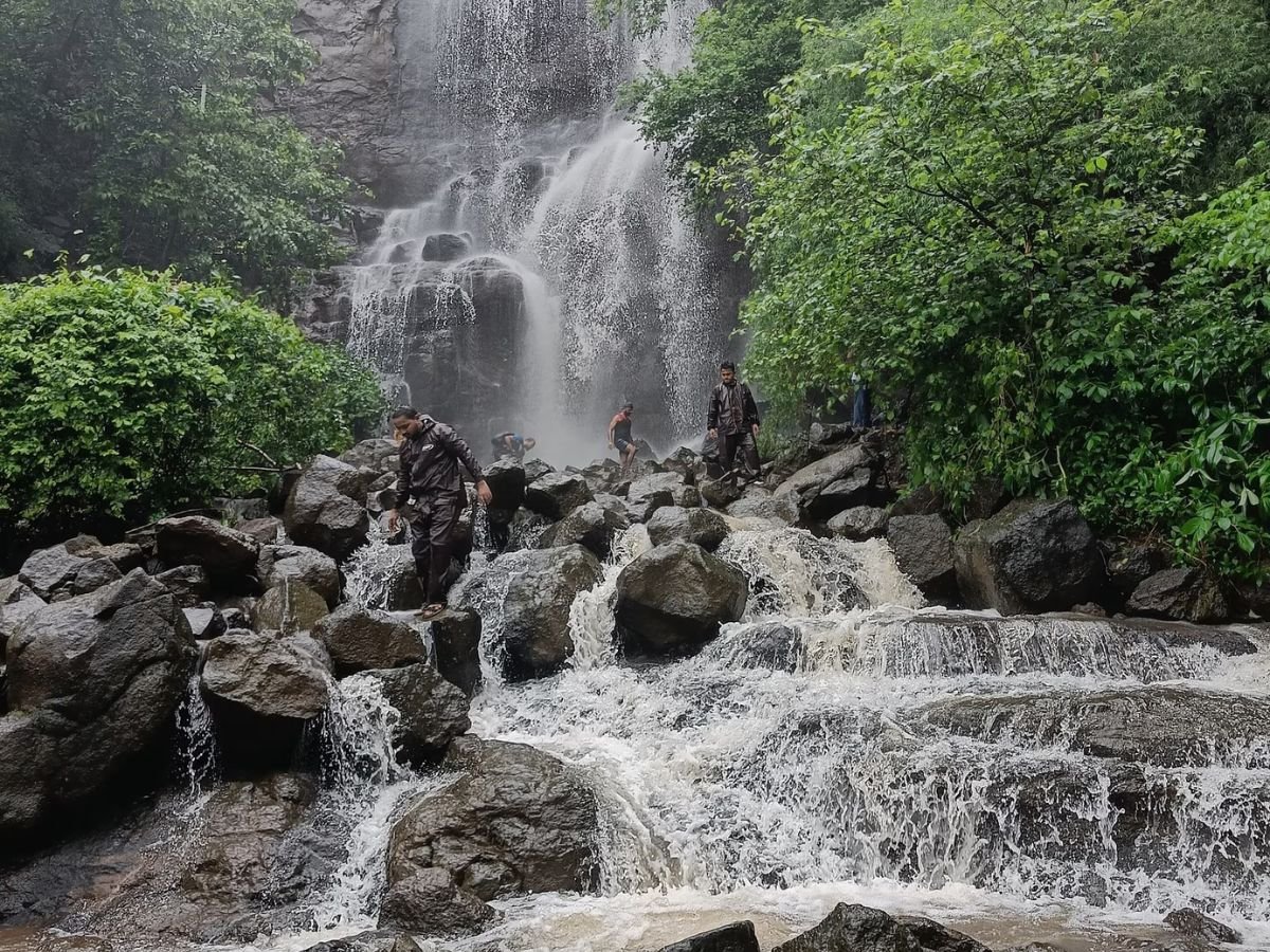
Gavli Dev is best described as an entry-level trek with short distance but real monsoon risk. The average route is roughly 1.5 to 2 km one way, with an elevation gain around 150–200 meters, and takes about 20–30 minutes for an average walker.
The difficulty is usually “easy to moderate,” but the label changes the moment basalt turns wet. In the rains, the worn rock steps become slippery, and small mistakes happen when people try to overtake groups or pose near edges.
Terrain Stages (So Readers Don’t Feel Lost)
The route typically starts with a scrub zone where the trail is beaten earth and gets muddy in monsoon. This section is where footwear matters most, because slippery mud creates more falls than the waterfall area itself.
Next comes a lower cascade and rocky plateau, where early stream crossings begin and many casual visitors stop. If someone is coming with kids or elders, this is often the sensible turnaround point because the climb after this becomes steeper.
The Ascent and the Summit Plateau
After the plateau, the route becomes a steeper ascent over basalt rock, and the carved steps are typically worn. In wet weather, the surface behaves like polished stone, and crowd pressure increases the risk because people move in packs, not at their own pace.
At the top is the summit plateau, where the temple is located and the source area begins. This point offers panoramic views of the Ghansoli–Airoli skyline, Thane Creek, and even the distant Mulund hills on clear monsoon breaks.
Best Time to Visit Gavli Dev Waterfall
The peak season is the heavy monsoon window, especially July and August, when weekends can see thousands of visitors. This is when the waterfall looks most dramatic, but it is also when trail compaction, crowd noise, and safety incidents increase sharply.
A better strategy for serious visitors is to target a morning slot on a day when rainfall has been steady but not extreme. The flow remains strong, but visibility improves, and you avoid the late-day rush that pushes people to take risky photos near cliff edges.
Crowd Reality and the “Instagram Effect”
The monsoon crowd is not one type of visitor. You will see college groups, families, first-time trekkers, and content creators, often all arriving at the same time during weekend peak hours. This diversity makes the place lively, but it also makes safety management harder because everyone has a different risk sense.
Social media has popularized specific viewpoints at Gavli Dev, and that creates queues at dangerous edges. The risk is not just slipping, but overcrowding in tight spots where one wrong push can trigger a chain reaction.
Safety First: What Can Go Wrong at Gavli Dev
Gavli Dev is generally considered safer than Pandavkada, but that does not mean it is risk-free. The site’s main risk profile is not deep-water drowning, but a combination of sudden surge, slippery rock, and people moving too close to edges for photos.
The danger becomes higher because most visitors treat it as a picnic spot, not a natural hazard zone. In monsoon, water behavior changes quickly and the same “small cascade” can become aggressive within minutes if rainfall intensifies on the ridge above.
Flash Flood Hazard: The Risk People Don’t See
The Gavli Dev stream can rise very fast due to a funneling effect in the basalt gorge. Your research explains that a high-intensity rainfall event, for example 50mm in one hour on the Parsik ridge, can concentrate runoff instantly into the stream.
The most dangerous scenario is when visitors are bathing in lower pools without realizing it is raining heavily at the summit. This “wall of water” effect can strand people or sweep them away, and rescue incidents requiring the Fire Brigade have been recorded almost every monsoon season.
Terrain Hazards: Slippery Basalt and the Real Injury Pattern
Wet basalt is not just “a bit slippery.” Your research notes algae and moss can create near-zero friction, and the common injuries are fractures and sprains caused by slips. That is why footwear matters more than fitness here.
The second terrain risk is crowd behavior at narrow sections. When the trail is packed, people try to overtake and step on unstable edges, which is exactly when slips become group accidents rather than individual mistakes.
The “Selfie” Risk: Cliff Edges Without Protection
The waterfall edge is unprotected, which is an important sentence to state clearly in your blog. Visitors who go too close to the precipice for photographs risk falling roughly 40–50 feet onto rocks, and this is not a rare behavior during peak monsoon weekends.
This is also why timing matters. Early morning visits reduce crowd pressure, reduce queues at dangerous viewpoints, and give people the space to make safer choices without being pushed from behind.
What to Carry (Simple Checklist That Prevents Problems)
For Gavli Dev, the highest-value items are not fancy trekking gear. A sturdy pair of shoes with strong grip, a rain layer, and a dry bag for phone and wallet prevent most small disasters that ruin a trip. The reason is the trail becomes muddy in the scrub zone and worn, slippery on the basalt ascent.
Carry basic hydration and a small first-aid strip pack because the site is crowded and accidents are mostly small slips and cuts. In peak months, you should also plan your return time early, because crowd density increases and trail movement becomes less predictable.
Who Should Avoid Visiting in Peak Monsoon
If rainfall is heavy or continuous, families with very small kids and visitors with knee or ankle issues should avoid going beyond the lower cascade. The lower plateau is often the limit for casual visitors anyway, and pushing beyond it in heavy rain mostly increases risk without improving the experience.
Visitors who are mainly coming to bathe should also avoid the lower pools in unstable weather because flash-rise risk is specifically linked to bathing behavior in the danger zone. This is a critical point for local guides because it is the most preventable hazard.
The Pollution Problem: Why People Call It a “Dumpyard”
Your research describes solid waste pollution as the most visible scar on the Gavli Dev landscape, and notes that media reports have used the word “dumpyard” for this precinct. Plastic bottles, single-use cutlery, and multilayer packaging are discarded indiscriminately and then washed downstream during heavy rains.
This is not only ugly, it has a real urban impact. When waste is carried downstream it can clog municipal drains in the MIDC area and contribute to urban flooding, which connects this waterfall directly to city-level infrastructure problems.
Alcohol, Broken Glass, and Why It’s a Serious Hazard
A difficult truth: the site is a hotspot for illicit drinking, and broken glass bottles are described as ubiquitous. Glass shards embed into soil, creating a hazard that is difficult and dangerous to clean, and it affects both trekkers and wildlife.
This is the kind of detail that builds E-E-A-T because it matches what locals observe on weekends. It also supports a clear recommendation: avoid late evening visits and avoid visiting with groups that treat the spot like a party zone.
Why Waste Management Fails Here (Not Just “People Are Bad”)
Your research explains that waste management struggles because garbage trucks cannot access the trail. Cleaning requires manual carrying by workers, which is labor-intensive, expensive, and easy to fail during peak monsoon footfall.
It also notes an infrastructure deficit where bins at the base overflow and there are virtually no bins on upper trails, plus a behavioral deficit due to lack of enforcement and absence of permanent security presence. This explains why the problem repeats every year.
Responsible Visiting: The One Rule That Matters
If you want Gavli Dev to stay open and not turn into a restricted zone like other waterfalls, carry your waste back down. The site is already under pressure from foot traffic that compacts soil, widens trails, and disrupts wildlife through noise.
A simple principle works best here: treat the trail like a nature corridor, not a picnic ground. That single shift reduces litter, reduces alcohol-driven incidents, and keeps the experience safer for families and first-time trekkers.
Timings and Entry Fee (What You Should Assume, What You Must Verify)
Gavli Dev is generally treated as an open monsoon spot, but ground conditions change fast based on rainfall, crowding, and local advisories. Your safest writing approach is to present visiting as a daytime activity and recommend reaching early, because the biggest risk spike happens when crowds build and visibility drops later in the day.
On entry fee, your research recommends regulated entry as a future solution, which means fee collection can be seasonal or trial-based if authorities implement it. So instead of asserting a fixed fee, write: “Entry rules may change during peak monsoon. Confirm at the base and follow any local notice.” This keeps the post accurate and future-proof.
Gavli Dev vs Pandavkada (Safety Comparison People Actually Search)
Gavli Dev is widely seen as safer than Pandavkada because the catchment is smaller and the waterfall is a moderate cascade, not a massive plunge. The primary risk at Gavli Dev is slipping and falls, while Pandavkada is known for drowning and being swept away due to extremely violent flow changes.
A key operational difference is restrictions. Gavli Dev is generally accessible with advisories, while Pandavkada is frequently banned under restrictions in monsoon. This is why families and first-timers often choose Gavli Dev, but they still need to treat it as a hazard zone in heavy rain.
Conclusion
Gavli Dev is a reminder that Navi Mumbai still has living nature corridors even beside heavy urban infrastructure. It functions as a biodiversity refuge, a hydrological sponge, and a local spiritual anchor because of the temple on the summit plateau.
FAQs
Frequently Asked Questions